
Site Plan Architects answers the question, “What is a site plan?” before you spend time, money, or effort on a property project that may not fit your land the way you expected. Think of a site plan as the bigger picture of your property. It shows where your building will sit, how you will access it, where parking or landscaping may go, and how important features such as property lines, setbacks, easements, and utilities fit into the plan. Whether you are building a new home, adding a garage, planning a commercial project, or preparing for a permit, understanding your site plan can help you see the project clearly before construction begins.
For property owners, a site plan answers an important question: What will this property look like when everything is placed on the site? Instead of looking at separate drawings or trying to imagine where everything will go, a site plan brings the important information together in one clear view.
At Site Plan Architects, we create professional site plans that help property owners, builders, contractors, architects, and developers present their projects clearly. Our goal is to make site planning simple, accurate, and easy to understand.
What is a site plan?

A site plan is a scaled drawing or visual representation of a property that shows the existing and proposed features of a site. It is usually drawn from a top-down view, meaning you are looking at the property as if you were standing above it.
A site plan can show the property boundaries, existing buildings, proposed buildings, driveways, parking areas, walkways, landscaping, fences, utilities, drainage features, trees, easements, setbacks, and other important site information.
The exact information required can vary depending on the project and the local jurisdiction. Different cities, counties, and municipalities in the United States can have their own requirements for site plans. This means a site plan prepared for a residential project may look different from one prepared for a commercial development.
The main purpose is simple: to show how the property is being used and how proposed changes will fit within the site.
For example, imagine that you want to build a detached garage in your backyard. A floor plan can show the inside layout of the garage, but it does not explain where the garage will be located in relation to your house, property line, driveway, or other features. A site plan provides that bigger picture.
It can show the existing house, proposed garage, distance from the property boundaries, driveway access, landscaping, fences, utilities, and other relevant features.
This is why site plans are commonly used during planning and permitting processes.
Why do you need a site plan?
A site plan helps different people understand the same property without having to rely on verbal descriptions.
A property owner may use it to explain a proposed project. A contractor can use it to understand where construction should take place. A designer can use it to coordinate the project with the surrounding property. A local planning or building department may review it to determine whether the proposed development meets applicable requirements.
A good site plan can also help identify potential problems before construction begins.
For example, a proposed structure may appear to fit on a property until its required setback from a property line is considered. A driveway may look suitable until access, parking, drainage, or other site conditions are reviewed. An addition may fit beside a house but conflict with an easement.
By showing these relationships visually, a site plan can help property owners make better decisions before spending money on construction.
What is the difference between 2D and 3D site plans?
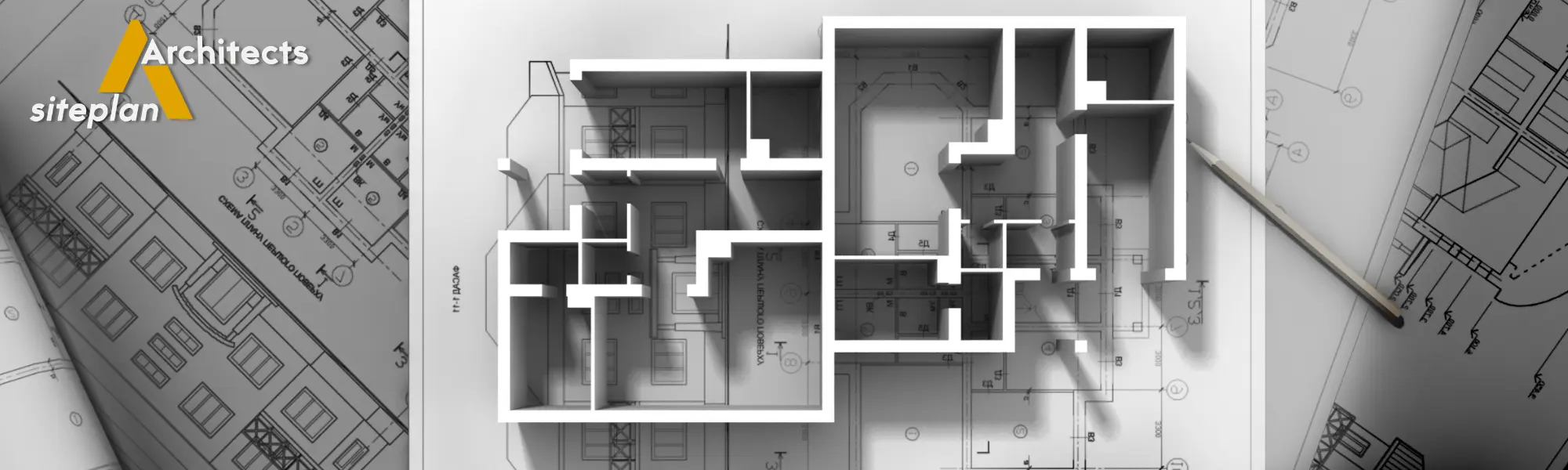
One of the most common questions about site plans is the difference between a 2D site plan and a 3D site plan.
A 2D site plan is a flat drawing that presents the property from a top-down view. It focuses on location, dimensions, boundaries, distances, and the relationship between different site elements.
For example, a 2D site plan may show:
- Property lines
- Existing structures
- Proposed structures
- Driveways
- Parking areas
- Walkways
- Setbacks
- Easements
- Landscaping
- Trees
- Utility locations
- North direction
- Dimensions and measurements
A 2D plan is especially useful for planning, documentation, permitting, and communicating technical information.
A 3D site plan adds another level of visual understanding. Instead of showing the property only from above, a 3D representation can show buildings, landscaping, pathways, parking areas, and other features with depth and perspective.
A 3D site plan can be particularly helpful when a client wants to visualize how the finished development may look.
The two are not necessarily competitors. They can serve different purposes. A 2D site plan is generally better for clear technical information, while a 3D site visualization can make the design easier to understand visually.
The right choice depends on the project, the purpose of the drawing, and what the local authority requires.
Why is a site plan important?
A site plan is important because property development involves much more than the building itself.
A building does not exist in isolation. It sits on a piece of land and interacts with driveways, neighboring properties, streets, utilities, landscaping, parking, drainage, and other site features.
A site plan helps bring these details together.
Site plans help with planning
Before construction begins, it is important to understand how the proposed project will fit on the property. A site plan gives you a visual starting point for making those decisions.
It can help identify whether there is enough space for the proposed structure, where access will be provided, and how the project relates to existing features.
Site plans support permit applications
Many building and development projects require drawings as part of a permit or approval process. Depending on the project and jurisdiction, a site plan may be one of the documents requested by a local building or planning department.
The requirements are not identical everywhere in the USA. Some jurisdictions may request more detailed information than others.
For this reason, it is important to understand the requirements that apply to your specific property before preparing the final plan.
Site plans improve communication
A drawing can often explain something faster than several paragraphs of text.
When a homeowner, contractor, architect, engineer, planner, and local reviewer are all looking at the same site plan, everyone has a clearer understanding of the proposed arrangement.
Site plans can identify conflicts early
A site plan can reveal potential conflicts involving setbacks, access, parking, easements, existing structures, utilities, or landscaping.
Finding a problem during planning is generally much easier than discovering it after construction has started.
Other Uses for a Site Plan Beyond Construction
Although site plans are strongly associated with construction, their uses go beyond building a new structure.
Property owners may need site plans for additions, accessory structures, renovations, landscaping projects, parking changes, driveways, pools, fences, patios, decks, commercial improvements, property development, and other changes to the use or layout of land.
A site plan can also be useful when discussing a project with contractors or other professionals.
For example, if you are planning a backyard improvement, a site plan can help show where a proposed patio, pool, outdoor structure, fence, or landscaping feature will be located.
For commercial properties, site plans can become even more important because the property may contain parking, loading areas, pedestrian circulation, signage, landscaping, multiple buildings, and other features.
Local building and zoning codes
Building and zoning requirements are an important part of site planning in the United States.
A site plan does not automatically mean that a project is approved. The proposed development may need to comply with applicable local requirements.
These requirements can involve issues such as setbacks, building height, lot coverage, parking, access, landscaping, drainage, fire access, utilities, signage, and land use.
Zoning rules determine how land can generally be used and what types of development may be permitted in a particular area. Building codes address many aspects of construction and safety.
Because requirements vary between jurisdictions, property owners should check with the appropriate local authority for project-specific requirements.
This is especially important if you are preparing a site plan for permit submission.
A professionally prepared site plan can organize the required information clearly, but local authorities determine what they require for approval.
Do I need a site plan?
Whether you need a site plan depends on what you are doing with the property and what your local jurisdiction requires.
A simple property improvement may not require the same documentation as a new commercial development. A new building may require a detailed site plan, while another minor project may have different requirements.
If you are unsure, the best approach is to check with the local building, planning, zoning, or permitting department responsible for your property.
You may need a site plan if you are:
- Building a new structure
- Adding an extension
- Constructing an accessory structure
- Adding or changing parking
- Installing a pool
- Changing a driveway
- Adding a fence
- Developing commercial property
- Making significant landscaping changes
- Applying for certain permits
- Changing how a property is used
- Submitting plans for zoning or development review
The exact requirement depends on the project and location.
When is a site plan required?
A site plan is commonly required when a local authority needs to understand how a proposed project will affect the property and surrounding area.
For example, a new home may require a site plan showing the proposed house in relation to property boundaries, setbacks, driveway access, utilities, and other site features.
A commercial development may require much more information because the project can affect parking, traffic circulation, landscaping, pedestrian access, stormwater management, fire access, and surrounding properties.
A site plan may also be requested when changing an existing property.
It is important to remember that there is no single nationwide site plan requirement that applies identically to every project in every part of the United States. Requirements can vary by state, county, city, municipality, zoning district, property type, and project.
That is why checking local requirements before finalizing your drawing is an important step.
What’s included in a site plan?
The contents of a site plan depend on the project, but a professional plan commonly includes the information needed to understand the property and proposed development.
The property boundary is one of the most important parts. It establishes the area being shown and provides a reference for locating structures and other improvements.
Existing structures may also be shown so the reviewer or property owner can understand what is already on the site.
Proposed structures are then shown in their intended locations.
Other information can include dimensions, setbacks, driveways, parking spaces, walkways, landscaping, trees, fences, utilities, easements, drainage features, and other relevant details.
A north arrow and scale are also commonly used to help users understand the orientation and size of the site.
The final content should be based on the project and the requirements of the authority reviewing the plan.
What Key Elements Does a Site Plan Include?
A good site plan should make the property easy to understand.
Property lines
Property lines show the legal boundaries of the property being developed or improved.
They provide the basic framework for placing buildings and other improvements.
Existing buildings
Existing houses, garages, sheds, commercial buildings, or other structures can be shown to provide context.
This helps distinguish between what already exists and what is being proposed.
Proposed structures
The proposed building or improvement is one of the main features of a site plan.
Its location, dimensions, and relationship to the property boundaries should be clearly represented.
Setbacks
Setbacks show the required or proposed distance between structures and property lines or other applicable boundaries.
They are important because zoning regulations may establish minimum distances that must be maintained.
Driveways and access
A site plan can show how vehicles enter and leave the property.
This can include driveways, access points, parking areas, internal circulation, and connections to public roads.
Parking
For many residential and commercial projects, parking is an important part of the site layout.
The plan may show parking spaces, drive aisles, accessible parking where applicable, and the relationship between parking and buildings.
Landscaping
Landscaping can include trees, shrubs, lawns, planting areas, landscape buffers, and other outdoor features.
Some projects may have specific landscaping requirements under local zoning regulations.
Utilities
Where relevant, the site plan may identify existing or proposed utility features.
The level of utility information depends on the project and the requirements of the reviewing authority.
Easements
Easements are another important site feature.
An easement can give another party certain rights to use a portion of the property for a specific purpose, such as utilities or access.
Because an easement can affect where construction is allowed, it is important to identify applicable easements when preparing a site plan.
North arrow and scale
The north arrow helps users understand orientation.
The scale helps users understand the relationship between the drawing and the actual property.
Dimensions
Dimensions provide measurable information about distances and sizes.
A professional site plan should make important relationships easy to understand rather than forcing the reader to estimate distances visually.
What’s the difference between a site plan and a floor plan?
A site plan and a floor plan are different drawings, even though both may be used for the same construction project.
A site plan shows the property, while a floor plan shows the interior layout of a building.
For example, a floor plan can show bedrooms, bathrooms, kitchens, living areas, doors, windows, walls, stairs, and other interior spaces.
A site plan can show where that building is located on the property.
Think of it this way:
The floor plan answers:
“What is inside the building?”
The site plan answers:
“Where is the building located on the property, and what surrounds it?”
Both drawings can be important, but they serve different purposes.
A site plan provides the larger property context, while a floor plan focuses on the building’s internal arrangement.
Why are fire hydrants and easements included on a site plan?
Fire hydrants can be important because emergency access and fire protection are relevant considerations for many developments.
Depending on the project and local requirements, a site plan may need to show nearby fire hydrants, fire lanes, fire department access, or other fire-related site features.
Showing these features can help reviewers understand whether emergency access is properly considered.
Easements are included because they can affect how a property can be developed.
For example, a utility company may have an easement across a portion of the property. The property owner may own the land, but the easement can provide another party with specific rights over that area.
If a proposed structure is placed over an easement without considering the applicable restrictions, the project may face problems.
This is why easement information should be reviewed carefully when preparing a site plan.
Why Off-Property Landscape Features Matter
A property does not exist separately from everything around it.
Features outside the property can sometimes be relevant to understanding the proposed development.
For example, nearby trees, streets, sidewalks, neighboring structures, drainage conditions, utility features, or other landscape elements may influence the way a property is designed.
A site plan can provide context around the property when that information is relevant to the project.
Off-property features can also help make the drawing easier to understand.
Imagine a proposed driveway near a street. Showing the relationship between the driveway and the street provides much more useful information than showing the driveway alone.
Similarly, a commercial project may need to consider neighboring access, sidewalks, parking relationships, or surrounding development.
The exact information shown should depend on the project and local requirements.
How to obtain a site plan of your property
There are several ways to obtain information that can help create a site plan.
Some property owners may already have previous plans, surveys, architectural drawings, or development documents.
Public property records may also provide useful information, depending on the location.
However, an existing document is not always suitable for a new project.
Property conditions can change. Previous drawings may be outdated. Measurements may not match current conditions. A document created for one purpose may not contain the information needed for another permit or project.
For this reason, it is important to understand what your project actually requires.
If you need a professional site plan, you can provide the available property information and project details to a site plan professional who can prepare the drawing based on the available information and applicable requirements.
How the online site plan process works
Online site plan services can make the process easier for property owners who do not want to manage complicated drawing work themselves.
The process generally starts by collecting basic project information.
This can include the property address, available property documents, existing site information, measurements, photographs, surveys, and details about the proposed project.
The next step is to determine what needs to be shown on the plan.
For example, a homeowner planning a new garage may need a plan showing the existing home, proposed garage, driveway, property boundaries, setbacks, and other relevant features.
A commercial project may require considerably more information.
Once the necessary information is available, the site plan can be prepared using professional drafting software.
The drawing is then reviewed for clarity, dimensions, labels, orientation, and other project-specific details.
Depending on the purpose of the plan, the final document may be provided in a format suitable for printing, sharing, or submission.
One important point is that an online service does not remove the need to follow local requirements. The local authority remains the best source for confirming what documentation is required for a specific project.
How much does a site plan cost?
The cost of a site plan can vary significantly depending on the project.
A simple residential site plan may require less work than a detailed commercial development plan.
Factors that can influence cost include the size and complexity of the property, the amount of existing information available, the level of detail required, the type of project, the number of structures, landscaping, parking, utilities, topography, and local submission requirements.
If a property requires additional surveying or professional services, those costs may be separate from drafting the site plan itself.
Rather than looking only at the price of a drawing, property owners should consider whether the plan contains the information needed for their specific purpose.
A clear and properly prepared site plan can save time by reducing confusion and helping identify potential issues earlier in the process.
Can a site plan be created from an existing survey?
Yes, an existing survey can often provide valuable information for preparing a site plan.
A survey may provide information about property boundaries, dimensions, existing structures, elevations, easements, and other conditions depending on the type of survey.
Using accurate source information can make the site planning process more reliable.
However, not every survey contains everything required for a particular project.
A site plan may need to combine information from a survey with project-specific design information, such as the location of a proposed building, parking area, landscaping, or other improvements.
If the project requires a survey, the property owner should use the type of survey or professional service required by the applicable jurisdiction.
Can a site plan be used for a building permit?
A site plan can be part of a building permit package when the local authority requires one.
However, the exact requirements depend on the jurisdiction and type of project.
Some permit applications may require a simple site plan, while others may require a detailed drawing containing dimensions, setbacks, utilities, drainage, landscaping, parking, fire access, and other information.
It is therefore important not to assume that one site plan format will be accepted everywhere.
Before preparing a final permit submission, review the instructions provided by the local building or planning department.
What makes a good site plan?
A good site plan should be clear, organized, accurate, and easy to read.
The reader should be able to quickly understand the property boundaries, existing conditions, proposed improvements, dimensions, access, and important site relationships.
Good labeling is important.
The plan should not contain unnecessary visual clutter that makes important information difficult to find.
Scale and orientation should also be clear.
Most importantly, the site plan should be prepared according to the purpose for which it will be used.
A plan for a simple residential improvement may not need the same level of detail as a commercial development.
Common site plan mistakes to avoid
One common mistake is starting the drawing without first understanding the local requirements.
A property owner may spend time preparing a plan only to discover that the reviewing authority needs additional information.
Another mistake is using outdated property information.
If an old drawing does not accurately represent the current site, it may create confusion.
Incorrect dimensions can also create problems.
Property lines, setbacks, building dimensions, parking areas, and other important measurements should be based on reliable information.
Ignoring easements is another issue.
An easement may affect where a structure or improvement can be placed, so it should not be overlooked.
Another common mistake is treating the site plan like a floor plan.
A site plan is about the relationship between the building and the property. It needs to communicate the overall site arrangement, not just the building’s interior.
Site plan for residential properties
Residential site plans are commonly used for homes, additions, garages, pools, decks, patios, fences, driveways, and other property improvements.
For a residential property, the plan may show the existing house, proposed improvement, property lines, setbacks, driveway, walkways, landscaping, trees, fences, utilities, and other relevant features.
For example, if you want to build a detached garage, the site plan can show exactly where the garage will sit in relation to the house and property boundaries.
If you want to add a swimming pool, the plan can show the pool’s proposed location and its relationship to the home, property lines, and other site features.
The level of detail required depends on the project and local regulations.
Site plan for commercial properties
Commercial site plans can be more complex because commercial properties often involve multiple site functions.
A commercial plan may include buildings, parking, drive aisles, loading areas, sidewalks, landscaping, signage, utilities, fire access, entrances, exits, and other features.
The plan needs to communicate how customers, employees, deliveries, emergency vehicles, and pedestrians interact with the site where applicable.
Because commercial developments can have a greater effect on surrounding properties and public infrastructure, local review requirements may also be more detailed.
A professionally organized site plan can make the project easier for property owners, designers, contractors, and reviewers to understand.
Do site plans show property boundaries?
Property boundaries are commonly shown because they provide the framework for understanding the site.
Knowing where the property begins and ends is essential when deciding where to place structures, parking, driveways, landscaping, and other improvements.
However, property boundary information should come from appropriate and reliable sources.
A site plan drawing should not be treated as a replacement for a legal boundary survey when a survey is required.
Do site plans show setbacks?
When setbacks are relevant to the project, they are commonly shown on site plans.
A setback is generally the required distance between a structure and a property line or another specified feature.
Setbacks can vary based on local zoning rules, property type, zoning district, structure type, and other conditions.
Showing setbacks helps reviewers and property owners understand whether the proposed structure is positioned appropriately within the property.
Why should you choose professional site plan services?
Preparing a site plan may look simple at first, but a useful site plan requires careful organization.
The challenge is not only drawing a building on a piece of land. The plan needs to communicate multiple relationships clearly.
At Site Plan Architects, we provide professional site plan services for property owners, builders, developers, and other clients who need clear and organized site documentation.
Our services can support different types of projects, including residential and commercial site plans, depending on the project requirements.
We focus on creating drawings that are easy to understand and organized around the information needed for the specific project.
Instead of trying to create a complicated plan from scratch, property owners can provide their available information and project requirements and work with a professional team to prepare the site plan.
Choose Site Plan Architects for your site plans
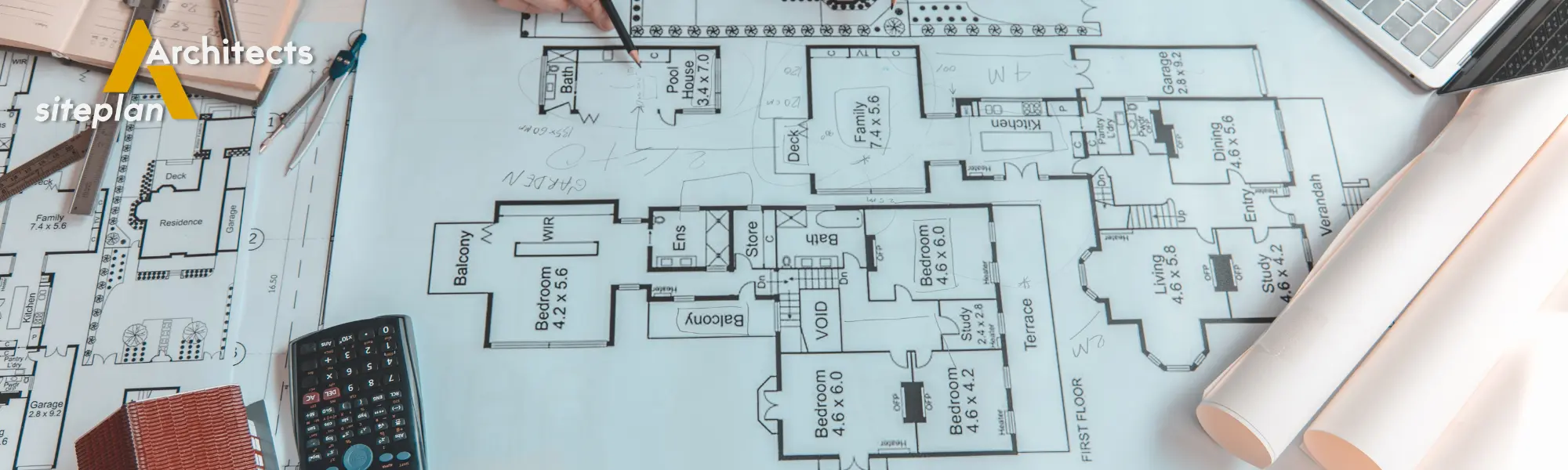
Choosing the right team for your site plan can make the process easier from the beginning.
At Site Plan Architects, we understand that every property and project is different. A homeowner planning a small improvement has different needs from a developer preparing a larger project.
That is why we approach each site plan according to its intended purpose.
Our focus is on clear drawings, organized information, and professional presentation.
Whether you need a site plan for a residential improvement, a commercial property, a proposed structure, landscaping, parking, or another development purpose, we can help turn available property information into a clear site plan.
A good site plan should not leave the reader guessing.
It should make it easy to understand what exists, what is proposed, where everything is located, and how the different parts of the property relate to one another.
What information do you need to provide for a site plan?
The information required depends on the project, but having useful property information ready can make the process smoother.
You may need to provide the property address, existing survey if available, property dimensions, photographs, existing building information, proposed project details, and any available documents from your local authority.
If you already have a previous site plan or architectural drawing, that can also be useful.
For a new structure, provide its proposed dimensions and intended location if known.
For a pool, garage, addition, driveway, parking area, fence, or landscaping project, explain what you want to add and where you expect it to be located.
The more accurate the source information, the easier it is to create a useful plan.
Site plans and property development
Site plans play an important role in property development because development decisions involve the entire site rather than only one building.
Before a project moves forward, developers need to understand how buildings, parking, access, landscaping, utilities, drainage, and other features will fit together.
A site plan allows these relationships to be reviewed visually.
This can help during early planning as well as later documentation and approval stages.
For larger projects, the site plan may work alongside other drawings and professional documents, including architectural plans, civil drawings, landscape plans, engineering documents, surveys, and other project information.
Each document has its own purpose, but the site plan provides an important overview of the property.
Can I make my own site plan?
In some cases, property owners can prepare a basic site drawing themselves.
However, whether a self-prepared drawing is acceptable for a particular permit or approval depends on the local authority and project requirements.
A simple sketch may help explain an idea, but a professional site plan generally needs more structured information, accurate dimensions, clear labeling, scale, orientation, and other project-specific details.
If the site plan is being submitted for an official purpose, check the submission requirements before deciding how to prepare it.
For projects where accuracy and presentation matter, professional site plan drafting can save time and reduce confusion.
How Site Plan Architects can help
At Site Plan Architects, our goal is to make site planning easier for property owners and project professionals.
We can help organize site information into a professional drawing that clearly communicates the proposed project.
Our site plan services can be useful for residential properties, commercial properties, development projects, additions, accessory structures, parking layouts, landscaping projects, and other site improvements.
The exact scope depends on the project and the information available.
We also understand that property owners may not always know exactly what information needs to appear on a site plan.
That is why providing the project details and available documents at the beginning is important. From there, the plan can be developed around the project’s purpose and applicable requirements.
Key Takeaways
- A site plan is a visual representation of a property that shows existing and proposed features and their relationship to one another.
- It can show property boundaries, buildings, proposed structures, setbacks, driveways, parking, landscaping, utilities, easements, access, and other important site information.
- A 2D site plan provides a clear top-down view and is commonly useful for planning and documentation. A 3D site plan or visualization can provide additional perspective and help people understand how a proposed development may look.
- Site plans are important because buildings are only one part of a property. The surrounding site also needs to be considered.
- Whether you need a site plan depends on your project and the requirements of your local jurisdiction. Building and zoning requirements can vary throughout the United States, so always check with the appropriate local authority before submitting your project.
- A site plan is different from a floor plan. A floor plan focuses on the interior layout of a building, while a site plan focuses on the building’s relationship to the property and surrounding site.
- Easements, setbacks, access, parking, utilities, landscaping, and other features can all be important depending on the project.
- If you are planning a new structure or changing an existing property, starting with a clear site plan can help you understand the project before construction begins.
Site Plan Architects provides professional site plan services designed to make property planning clearer and easier. If you need a site plan for your residential or commercial project, our team can help prepare a clear and professional drawing based on your project information and requirements.